Thursday, February 4, 2016


Guidelines for giving a tip money in several countries in the world

Traveling Tips. In many countries around the world, have different habits in giving a tip or money for services. In some countries, especially the countries that have a pretty good tourism industry, has long had a tradition of its own to give this tip money. Here's a guide to give a tip to the waiter, clerk, taxi drivers, etc., in various parts of the world.

A restaurant in Vietnam. AeroTourismZone
A restaurant in Vietnam.
Each state usually has the typical food that became the flagship. However, for matters of giving a tip to the waiters can be a perplexing problem when we are in another country, which of course has different traditions in giving a tip. "Usually, people who travel to new areas of the world, they become less noticed cultural differences in a variety of situations," written on Visual.ly, a site that displays infografis about the difference of tip money.

Enter Jadon Stewart and infografis have documented habit of giving tip money around the world. As in North America, usually the guests are expected to give a tip of 15 to 20 percent, especially if the service charges are not included in the bill. Meanwhile, officers are carrying luggage, usually expect one to two dollars per bag. While money tip for the taxi drivers usually about 10 percent of the cost of a taxi. Different again with in China and Japan. In the both countries, travelers are not expected to give a tip to a taxi driver or bags carrier attendant. However, unlike in Hong Kong. Although included in the China, in Hong Kong has become customary to give a tip of 10 percent.

If you are still confused when determining how much tip money should be given, you just need to pay more than the amount listed on the bill. Then tell the waiter to save the extra money that you've paid. Here's a practical guide about tip money in several countries around the world.

Asia.
For restaurants service in India, give a tip of 10 percent of the bill if the service charge is not included in the bill. While in Japan and China, except Hong Kong, tipping is considered unusual for a restaurant. While Hong Kong and other countries could give a tip of 10 percent of the bill. For hotels in India, the guests usually give a tip about $ 1 per bag for the officer who brought the bag. While in Hong Kong, money tip of about 10 Hong Kong dollars. In India there is no fixed rule for giving tip money to taxi drivers, just exaggerating cash payment of the cost of a taxi and tell the driver to save more money than them. However, do not give tip money to taxi drivers in Japan and China.

Australia and New Zealand.
For a restaurant in Australia, give a tip of 10 percent of the bill. This applies to a fancy restaurant. While in New Zealand, no need to give a tip because they do not expect it. For hotels in Australia and New Zealand, the officer who brought the bag usually receive 1 to 2 dollars per bag. As for the taxi in Australia, exaggerating the fare payment and ask the driver to save the extra money from the payment. In New Zealand, the taxi drivers usually get a tip of 10 percent of the cost of a taxi.

Europe.
Restaurants in the European countries usually receive a tip of 10 percent of the bill. While at the hotel, the bags carrier clerk usualy to receive 1 to 2 euro per bag. For taxi drivers, just give more money when paying the fare and asked the driver to save money refund.

South America.
For restaurants, add 10% of the bill as a tip, if a service charge is not included in the bill. As for the hotel, give a tip of $ 1 for hotel workers. While the taxi drivers do not have to give a tip money, quite exaggerated on bill payments.

North America.
For restaurants, the tip money are usually given about 15% to 20% of the bill, especially if there is no additional on service charge. Add $ 1 to $ 2 per drink for bartenders officer. As for the hotel, the bags carrier clerk usualy to receive $ 1 to $ 2 per bag. While taxi drivers usually receive a tip of 10% of the taxi fare.

Middle East.
For restaurants, add 10% of the bill as a tip, especially if there is no service charge on the bill. Add 15% of the bill if you're in the state of Qatar and the United Arab Emirates. As for the hotel, the bags carrier clerk usualy to get U.S. $ 1 to U.S. $ 2. Meanwhile, taxi drivers do not expect a tip.

Africa.
Waiters in restaurants typically get 10% of the bill, especially if there is no service charge in the bill. Add 5% if you eat at a restaurant in the southern African country. Meanwhile, officers for carrier bags at the hotel, usually gets a tip of $ 1 per bag. For taxi drivers, provide 10% of the taxi fare.

Wednesday, February 3, 2016


Carocok Beach Tourism In West Sumatra, Indonesia


Indonesia Tourism. Carocok Beach is a very beautiful seaside tourist attraction and located on side west of Painan City, Pesisir Selatan District, West Sumatra province. About 200 meters to the west of the Carocok Beach attractions lies a small island white sandy called the Cingkuk Island. In this island there are ruins of the forts of the Portuguese people.

Carocok Beach, West Sumatera, Indonesia. AeroTourismZone
Carocok Beach, West Sumatera, Indonesia.
Carocok beach located in the Pesisir Selatan District, West Sumatra, has a beach atmosphere was relaxed and comfortable. Not only that, on the beach there are also some attractions that can be enjoyed by the tourists.

The sky was clear, the wind blows gently sloping beaches, sparkling white sand exposed to sunlight, the leaves of palm trees waving unsteadily, as if signaling to nature that there are visitors who came to relieve fatigue. This relaxed atmosphere is recorded when we recently set foot on the Carocok beach, Painan city, Pesisir Selatan District, West Sumatra.

Carocok beach is just 2 km from the center of Painan, precisely in the IV Jurai Subdistrict. The beach is always crowded with tourists, especially during the holiday season. Access to the beach is very easy and convenient. Especially after the Pesisir Selatan District Government completes supporting facilities for the comfort of tourists. Some culinary shop built there. There are also toilets are quite clean, not far from the beach.

In addition to beach atmosphere that makes travelers feel relaxed, Carocok beach also has some attractions that can be visited by tourists. Just a few meters from the beach, there is a cluster of coral islands connected by a bridge to the tip of Bukit Langkisau. The hill is also a famous tourist attraction in Painan. A wooded cluster of coral is called Batu Kereta Island. To reach the island, travelers need not cross oceans. The local government has built bridges linking several attractions in Coastal Carocok. No need to fear suffering because some shelters have also been built. Staying walk, we will arrive at the Batu Kereta Island.

Not only that, travelers can also stop by the Cingkuk island. The distance is only 200 meters from the Carocok beach. In Cingkuk island, tourists can see the ruins of the fort over Portuguese. Local people believe, this is where the Portuguese immigrants first set foot on Sumatra. Some of the tombs and inscriptions have been a silent witness traces of the Portuguese people here.

To reach the Cingkuk island, local fishermen often rent boats. Not too expensive, only Rp 5,000 to Rp 10,000 per person. Besides enjoying the natural beauty, tourists can also do some other marine activities. For example, swimming, fishing, diving, or simply observe colorful fish around the beach Carocok. Some inns are also available for travelers who want to stay overnight.

Thursday, January 7, 2016


Sentani Lake, a spectacular tourist destinations in Papua province, Indonesia

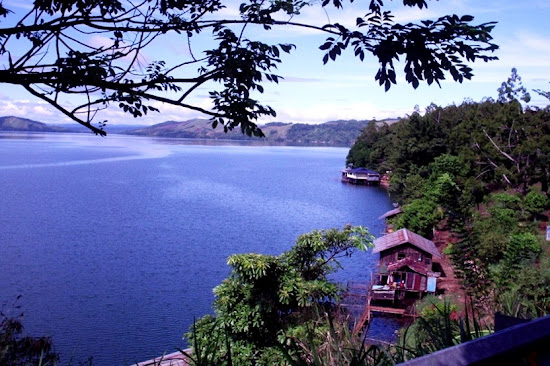
Indonesia Tourism. Sentani Lake is a popular tourist area in Papua. The lake is known for a calm water surface and is beautifully situated on the slopes of the Cycloops Mountain Nature Reserve. Sentani Lake runs between Jayapura city and Jayapura regency, Papua. This lake has an area of approximately 9360 hectares and located at an altitude of 75 meters above sea level. Sentani Lake is the largest lake in Papua. In this lake there are 21 small islands adorn this beautiful lake. Sentani meaningful sense of the word "here we live in peace." Sentani name was first mentioned by a Christian pastor, BL Bin, when carrying out missionary in the lake in 1898.

Sentani Lake, Jayapura, Papua province, Indonesia. AeroTourismZone
Sentani Lake, Jayapura, Papua province, Indonesia.
Sentani Lake is the name of a lake in Papua that has been very popular. Sentani Lake has a beautiful view with the water surface of sparkling in the sunshine override. The lake is located near Jayapura, the capital of Papua province. The surface of a calm lake water will make you feel peaceful like being in heaven. By embracing the Cyclops Mountains in the north and the lush vegetation as a beautiful backdrop to protect 24 villages that perched around the lake, make Sentani Lake is very beautiful and unique. Local residents around the lake has a friendly nature and creative. The results of their crafts are the best in the Papua province.

Sailing on Sentani Lake by boat is a wonderful experience. You can rent a boat motor in one of the villages. Feeling the breeze caressing your skin and hair when driving a motor boat on the lake surface, photographing ranks of stage house that standing on the banks of the lake, get acquainted with the locals, you can only get and feel in this lake. During World War II, Sentani Lake and surrounding areas once used as a training ground for landing the amphibious aircraft. Military facility was built by the Japanese and later taken over by the U.S. Army in 1944. Legend of the American war, General MacArthur, was said to have lived at Sentani Lake.

Life as a fisherman and lived close to the provincial capital, making most of the communities around Sentani Lake is open to the tourists. Stage house with fishpond and nets are a common sight on the lake. This lake is home to around 33 species of fish, which is almost half of whom are native species of fish this lake. Fish saws (Pristis Microdon) is a native fish this lake, but is now thought to have been extinct. Fish saws has become one of the ornaments on the Sentani wood crafts.

Sentani Lake. AeroTourismZone
Sentani Lake.
Stone painting

In the Taturi village, stone paintings are a marvel worth visiting. Situated on a small hill on the edge of the lake, you can enjoy this rock while boating. Another village that offers beautiful scenery is Doyo Lama, the art of rock painting. This lake is a fantastic starting point to understand the culture of Papua. Remains of World War II are scattered around the lake is such an important command headquarters during the war. On one of the hills, at Mount Ifar, a monument built to commemorate the American military command General MacArthur. From the monument you can enjoy a spectacular view of the lake.

Villages around Sentani Lake have different customs, but from some of the same culture as seen from their beliefs and rituals. For example, Isolo, was an event that unites different cultures from 24 villages around the lake. The ceremony can also be seen as part of the Sentani Lake Festival held during the month of June. While Asei Island is one of the artists around the lake. Asei Island is known for producing a patterned fabric bark beautiful and unique. Bark cloth is a traditional dress of women Sentani that most women move to catch fish in the lake. Spiral motifs symbolizing the fabric of life in Sentani Lake, there are crocodiles, fish saws, and mixed motives who also owned Asmat like bipane, a symbol of the wild boar tusks, and Asmat figures.

The annual cultural festival of Sentani Lake is a major attraction that held in Kalkote, Sentani. The festival is held at a height of 75 meters above sea level and enlivened with a war dance on the vessel, which is an spectacular attraction for tourists.

Access to Sentani Lake

Sentani Lake can be reached by driving for about 30 minutes to the west of the city of Jayapura. Sentani airport, located about 40 kilometers (25 miles) from Jayapura. As the capital of a vast province, Jayapura well connected with major cities in Indonesia, both by air and sea. It is recommended to always check your flight details. Outside the airport, kendaraa minibus was waiting for passengers to go to Jayapura. Minibus rental rate varies. So, make sure that you already know and agree with the rates offered by the driver before you decide to use the minibus.

Wednesday, January 6, 2016


The 5 rivers in Indonesia, which became a haven for rafting tourism

Indonesia Tourism. The 5 rivers in Indonesia, which became a haven for rafting tourism. Exercise torrent or commonly called rafting has been popularized by John Wesley Powell in 1869 in America. Now rafting the more interested people, including in Indonesia. Here are articles about the 5 rivers in Indonesia deserves to be a haven for fans of rafting tour. Five rivers in Indonesia, which is popular for traveled rafting is Alas river in Aceh, Citarik River in Sukabumi, Elo River in Magelang, Ayung River in Bali, and Nimanga River in North Sulawesi.

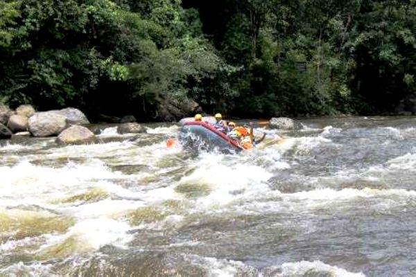
Exercise torrent or better known as rafting become one of the popular tourism activities. In Indonesia there are 5 river has rapids and river flows are very powerful. For travelers who like a challenge, rafting is an exciting activity. In the raft, you will work closely with the team to maintain a balance to keep from falling. Rapids and rushing river flows into the challenges that must be passed. Being soaking wet, that's for sure! If you have the guts, try to go the rivers in Indonesia following!

Rafting on the Alas River, Aceh. AeroTourismZone
Rafting on the Alas River, Aceh
1. Alas River, Aceh

Begin to test your guts of western Indonesia. Leuser National Park, Aceh, there are the Alas River which is known to have strong currents. River which empties into the Indonesia Ocean is suitable for beginners or who have professional rafting activities. Grade river is 3-4. Alas River is located at 165 km southeast of the City of Takengon, Central Aceh. Prepare stamina, because usually the River Alas journey can take up to 6 hours. Swift currents and rapids would mostly found along the way. Fun, you will cross the river flowing in the middle of a jungle. Do not be surprised, if you will often see wildlife such as deer, monkeys and various species of birds. For starters, the Alas River rafting starts from Muarasitulan Kutacane City to the City of Gelombang. As for the professional already, you can take the longer route, starting from Angusan, near Blangkejeran. Very exciting!

Rafting on the Citarik River, Sukabumi, West Java. AeroTourismZone
Rafting on the Citarik River, Sukabumi, West Java
2. Citarik River, Sukabumi, West Java

Not far from Jakarta, you can feel the rafting sensation that challenging on the Citarik River. The river is in the Halimun Mountain National Park, Cikadang, Sukabumi, West Java. Citarik River who had grade 3 was never empty of tourists, especially on weekends. Some routes could be an option for you to test the courage and skill in rafting activities. There rafting route that took over 1 hour with the distance of 5 km, or 4 hours with a mileage of 17 km. Your stamina will be drained while balancing on a rubber boat. Large boulders are scattered along the river is a challenge. You must be compact with a team to get through these obstacles. Fresh air is common here. Smell the air as much as you rest. Not only that, several waterfalls on the River Citarik also the other attraction.

Rafting on Elo River, Magelang, Central Java. AeroTourismZone
Rafting on Elo River, Magelang, Central Java
3. Elo River, Magelang, Central Java

In Blondo, Magelang regency, Central Java, your adrenaline will be driven while doing rafting in Elo river. Not hard to come here, its proximity to Borobudur or about 40 minutes from Yogyakarta. Elo river wading trip takes 2 to 3 hours. Varying depths and river rafting are quite heavy, making you have to be extra careful. This river that famous has profusely flows. Elo River has a grade 2-3. The river can also be tested for those who are just starting rafting activities. Although the challenge is to make the heart beat fast, natural feel of the surrounding pristine and cool will make you feel comfortable while resting. Beauty, coolness and shade trees around the Elo River always to hypnotic for the rafting participants.

Rafting on Ayung River, Bali. AeroTourismZone
Rafting on Ayung River, Bali
4. Ayung River, Bali

Bali is not only for relaxing or sunbathing on the shore. In this island, you can also prove adrenaline and guts. Try playing rafting on the Ayung River which is located in the village of Payangan, Ubud. Activities rafting on the Ayung River, starting in the area of Payangan and ending in Kedewatan village. You will travel for 2 hours with a distance of 12 kilometers. Strong current and large river rocks will challenge you along the river. Be prepared to break the silence of Ubud with your cries! Grade Ayung River is 2-3. The river is also suitable for beginners. There are other unique, in Ayung River you can see the carvings are beautiful with their large size on some cliff Ayung River. The carvings on the river bank is the work of artists in Ubud. Not only domestic tourists, foreign tourists also love to play rafting here.

Rafting on Nimanga River, North Sulawesi. AeroTourismZone
Rafting on Nimanga River, North Sulawesi
5. Nimanga River, North Sulawesi

Nimanga River in North Sulawesi can also be included in the list to do the rafting activities. The river is located in the village of Timbukar, Minahasa regency, North Sulawesi. Nimanga River will provide a different experience adrenaline test. Imagine, you will see the rapids that have 4 meters high! Yes, the Nimanga river is known has challenging rapids. This is where balance, cooperation, and courage will be tested. Grade level in the river is 3-5. So, you have to be careful. Wading on River Nimanga can take up to 5 hours. If you are tired, you can relax by the river and enjoy its natural beauty. If lucky, you can meet with Yaki, the typical monkeys in Sulawesi (Macaca nigra) and tarsiers.

That's the 5 rivers that challenge for the rafting activities in Indonesia. You can contact some tour operators that would facilitate traveling to do rafting. Remember, you should always be vigilant and follow the direction of the guides.

Monday, January 4, 2016


Lihaga Island Tourism Destinations in North Sulawesi, Indonesia

Tourism Information. Lihaga Island is one tourist attraction that is quite popular in North Sulawesi, Indonesia. Lihaga Island in the administrative area of North Minahasa regency. The island has a beach with sand so soft and white only has an area of 8 hectares. Lihaga Island is inhabited by one family who was given the task to maintain and manage the island as a tourism area.

Lihaga Island, North Minahasa Regency, North Sulawesi, Indonesia. AeroTourismZone
Lihaga Island, North Minahasa Regency, North Sulawesi, Indonesia.
North Sulawesi has the potential of marine and coastal tourism are very diverse. Who is not familiar with the underwater beauty of Bunaken? But Bunaken is just one of the many fascinating marine tourism destination in the province. Another marine tourism destination is the Island of Lihaga. Lihaga, is an island that only has an 8 ha. Being in the administrative area of North Minahasa regency. The island is located at the upper end of the island of Sulawesi in the form of letter K. If the dotted line is drawn, will form a virtual line sort from Lihaga Island up to General Santos, Davao In the Philippines. In this false line, there are also the islands of Sangir Talaud, Talise, Bangka, and the Gangga.

Lihaga Island has special advantages when compared to other islands in North Sulawesi. The sand is white and fine as flour, causing the island to be very tempting to visit. Lihaga Island also without residents. Only one family who was assigned to guard the island. They are in charge of cleaning the trash left behind by visitors. To get into the island, visitors are charged Rp 20,000 per person. The money will be used by the island guard to their operations.

Beach in Lihaga Island, North Sulawesi, Indonesia. AeroTourismZone
Beach in Lihaga Island, North Sulawesi, Indonesia.
To be able to reach the Lihaga island, from Manado can be reached by taking the route from the Port of Likupang. From Manado takes about 1.5 hours drive. Then rent a boat for crossing to the Lihaga island. About 45 minutes, we've reached to Lihaga Island. Boats for rent can accommodate up to 20 people with a rental rate of Rp 750,000. We recommend that you ask the boat driver to cross the waters near the island of Gangga. The island is a neighbor the Lihaga island also has a beautiful view with a resort owned by an Italian. Before you get down to the beach on the island of Lihaga, you should surround this island using a boat you are riding. Lip beaches will present an unforgettable sight. Gradient water from blue to green and topped with sea foam breaking on the white sand, it is a mesmerizing sight. Coupled with the views of the rock on the other side of the island.

Under the sea in the waters around the Lihaga island also presents beautiful views. When at the beach, gazebo with seating made of bamboo, is ready to welcome us. Playing with sand while chasing the waves is an attractive option. Swimming at the beach and snorkel is equally thrill.

On the island without population is already available toilets and changing rooms. Even had some wooden buildings are quite large. But before crossing into Lihaga, first do not forget to buy food and drinks at Likupang. Because in Lihaga no stalls and food vendors. Visitors can also stay at Lihaga, free of charge again. Sure to provide their own equipment overnight. If managed well, Lihaga Island will be one of the best destinations in North Sulawesi. But even so, every weekend, the Lihaga Island always crowded tourists. The island is also a favorite location for photographers. So, if you are in North Sulawesi, do not forget to stop by at the island of Lihaga.

Sunday, January 3, 2016


Jailolo Sea in Halmahera, a paradise for underwater photographers

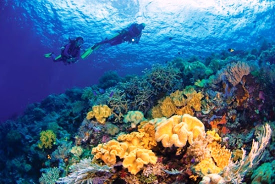
Underwater in the Jailolo Bay, West Halmahera, North Maluku province, it has a charming scenery. Underwater scenery in the Gulf Jailolo touted as a paradise for underwater photography enthusiasts. Diverse marine life, either in the form of animals and plants, it displays the condition of underwater scenery is phenomenal.

Jailolo Bay, West Halmahera, North Maluku province. AeroTourismZone
Jailolo Bay, West Halmahera, North Maluku province.
Met with a shark while underwater may cause some layman people to be afraid. But for the diver, this is something special. "I am very happy because the opportunity to meet with a shark in dive spot Pastofiri, really cool because the shark repeatedly passing before my eyes," said Ahmad after diving in the Jailolo Sea, West Halmahera, Tuesday, May 21, 2013.

According to the man who love this sports underwater, although his field of vision is not too far away, the Jailolo Sea have underwater scenery incredible. "All is still arranged neatly, the ecosystem was seen still very good," said Ahmad.

Jailolo bay that located in West Halmahera indeed save a million charm underwater. This bay is home to hundreds of specimens of coral and sea flowers, everything is gathered and grown under the Jailolo Sea that blue and quiet. Various underwater creatures exist, for example, glass fish, nudi branches, until the turtle, all to adorned under the Jailolo Sea. If you want to try extreme sports such as scuba diving, the Jailolo bay worth a try. Because of the diversity of marine life in Jailolo, you could be meet the marine animal that is rarely seen as mandarin fish whose existence only at a depth of 4.5 meters.

Diving in the Jailolo Bay. AeroTourismZone
Diving in the Jailolo Bay.

There are three diving spots are located on the sea Jailolo, namely Tanjung Kailupa, Babua Island and Atoll Pastofiri. Each has unique characteristics, such as Tanjung Kailupa, this place has a flat typography and have quite a lot of smooth corals and arcopora.

Additionally, you can ride a speedboat from Jailolo for 30 minutes in the direction Fastofiri and Babua Island to explore the waters there. The specialty of the Babua Island are its white sand that clean, beautiful coral stone and diving spot (NHR-2 and NHR-3) are not far from this island. In diving spot has an area famous for its beautiful scenery and impressive, named the Babua Wall. The divers love to linger there because there are a lot of mini seahorses with sized 1 cm, also lobster pink and nudibranch mollusks.

Underwater photography in the Jailolo Bay. AeroTourismZone
Underwater photography in the Jailolo Bay.

Currently, there are 12 diving sites spread across the regions of Jailolo and Loloda, West Halmahera. Clear sea with fairly good visibility up to 15 meters makes this place to be a paradise for underwater photographers. Exploring the Jailolo underwater will surely be an unforgettable experience, both for divers and underwater photographers. Meanwhile, the Babua island has a coral wall typography which is perfect for photography that using wide angle. Pastofiri atoll is equally interesting, with a depth of about 15-25 meters this place has topografislope and flat.

To try out feel the this sensation, you can come into Gilolo Dive Center which is located in the Gulf Jailolo. Its access easy, with using speed boat or boat barge from Dufa-Dufa Port which located in Ternate.

Thursday, December 31, 2015


Manusela National Park, The Beauty Of Heavens Edge Up Seabed In Maluku, Indonesia

Manusela National Park located on the island of Seram, Central Maluku, Maluku Province, is one of the most beautiful national parks of Indonesia. Beauty includes landscape of mountains, forests, beaches, to park on the sea floor. Manusela National Park which has an area of 189,000 hectares has been designated as a nature conservation area by the Ministry of Forestry of the Republic of Indonesia through Decree No. 281/Kpts-VI/1997.

Manusela National Park, Seram Island, Maluku Province. AeroTourismZone
Manusela National Park, Seram Island, Maluku Province.
Manusela National Park.

Manusela National Park is known as one of the most beautiful National Parks in Indonesia, with beautiful natural scenery and well preserved. Hilly scenery on the banks of which Markele, Manusela valley. Many of the activities that can be done here as exploring the woods, climbing, observing animals and plants. For beach lovers, this Manusela National Park is a paradise in the sea.

Manusela National Park area which covers 20 percent of the total area of the island of Seram. Here are Mount Binaya which is the highest peak in the Moluccas. Much of this area has very steep slopes with deep valleys. Most right to enjoy the beauty of this valley using motorized fishing boats and along the edge of the valley.

In addition, the National Park Manusela many unique to the region Sawai with various beautiful sea coral and is perfect for snorkeling and diving. In addition, in Sawai and surrounding areas can also enjoy beautiful views of the cliffs sawai or water tourism that can be enjoyed by using fast boats and longboats facilities belonging to the National Park Manusela. Manusela National Park information center is also located in Sawai State, precisely around the village Masihulan.

Manusela National Park is a representative type of coastal ecosystems, swamp forest, lowland rain forest and montane rain forest in Maluku. Vegetation types found in the Park are mangrove, beach, swamp forests, riverbanks, pamah tropical rain forest, montane forest and sub-alpine forests. Some plant species in this park are tancang (Bruguiera sexangula), mangroves (Rhizophora acuminata), fires (Avicennia sp.), Lime (Dryobalanops sp.), Pulai (Alstonia scholaris), ketapan (Terminalia catappa), pandan (Pandanus sp.), meranti (Shorea selanica), benuang (Octomeles sumatrana), matoa / lotion (Pometia pinnata), eucalyptus (Melaleuca leucadendron), various types of orchids, and ferns endemic (Chintea Binaya).

Binaya Mountain in Manusela National Park, Maluku Province. AeroTourismZone
Binaya Mountain in Manusela National Park, Maluku Province.
Approximately 117 species of birds found in Manusela National Park, where 14 of them endemic, like (Lorius garrulus), nape parrot purple / black head parrot (L. domicella), salmon-crested cockatoo (Cacatua moluccensis), king prawn (Halcyon lazuli and H . sancta), a large bird CERAM honey (Philemon subcorniculatus), and parrot king / parrot ambon (Alisterus amboinensis).

Spooky parrot is one of the species endemic to the island of Maluku, gravely threatened due to hunting and the destruction of their habitat. Other animals include the Timor deer (Cervus timorensis moluccensis), cuscus (Phalanger orientalis orientalis), soa-soa (Hydrosaurus amboinensis), wild boar (Sus celebensis), civet (Pardofelis marmorata), panama lizard (Tiliqua gigas gigas), dugong (Dugong dugon), green turtle (Chelonia mydas), and various types of butterflies.

There are rivers flowing, with steep topography configuration, six mountains / hills with Binaya highest mountain (± 3,027 meters above sea level).

Villagers Manusela, Ilena Maraina, Selumena, and Kanike, an enclave in the area of the National Park Manusela. The society has long been in the villages, and believe that the mountains are located in national parks can provide encouragement and protection in their lives. Their confidence will indirectly help maintain and preserve the national park.

Some locations / attractions to visit :
  • Merkele edge, edge Kabipoto, Wae Kawa: Exploring the forest, climbing, observing animals and plants.
  • Pasahari: Observations animals deer and birds.
  • Wai Isal: camping, exploring the forest, observing animals and plants.
  • Pilana: observing butterflies and exploring the forest.
  • Mount Binaya: Climbing, exploring the forests and waterfalls.
Cultural attractions outside the Park include Masohi Festival in November, race Kora Kora in April and Darwin-Ambon International Yacht in July in Ambon.

The best visiting season: May - October each year.

Accessibility :

Manusela National Park can be reached through the northern coast (Sawai and Wahai) or through the South coast (Tehoru and Moso). The route from Moso is perfect for those who love climbing, because the slope of the slope was about 30%. From Ambon to Masohi using the ferry every day about eight hours, continued to Saka by car about two hours, and using speedboat about two hours. Or, from Ambon to Wahai by ship about 24 hours (3 times a week). From Masohi to Tehoru by boat around nine o'clock, and continued to the Moso Saunulu village.

Friday, December 25, 2015


Bono waves in Kampar River, saddler The World Surfer

Bono waves has a height of up to 6 meters and often occur in the Kampar River is an amazing natural phenomenon and is rarely found in rivers in other regions. Kampar River is located in the province of Riau and West Sumatra has attracted the attention of surfers the world. So no wonder then if the Kampar River which has a wave Bono is now being promoted as a tourist destination with attractions for surfers.

Bono waves in Kampar River, Riau Province, Indonesia (Pic 1). AeroTourismZone
Bono waves in Kampar River, Riau Province, Indonesia (Pic 1).
Surfing on Bono Waves in Kampar River.

Kampar River in Riau is a natural wonder in Indonesia. Not without reason, this river has up to 6 meters high waves with a wavelength of 300 meters. You who have the guts, please surf here!

If a traveler usually surfing in the ocean, but differ in the village of Muda Island in Palalawan Regency, Riau. Kampar River in this area became the arena for surfers surfing world who have more guts. Kampar River is famous for wave Bono, who formed the waves and become a formidable challenge to be conquered. From the information on the official website of Tourism of Indonesia, the waves created by Bono wave height can reach 4 feet to 6 feet. Not only that, the wave can be rolled up to 2 hours at speeds up to 40 km / h. Powerful! In fact, the surfers have their own nicknames for these Bono wave. They called him by name Wave Seven Ghosts, because the waves generated can reach seven consecutive layers.

Why is that? Bono waves created by the meeting of the stream and ocean currents. Coupled with the wind and cliffs on the right and left, waves are created to be very strong. For novice surfers are advised not to try surfing there.

You know, it surfers from England named Steven King already broke the record in the Kampar River in 2013 ago. He conquered wave surfing Bono as far as 20.65 kilometers, for 1 hour 4 minutes. This man was admiring the wonders of the Kampar River and has its own assessment. "Wave Bono is a long and fantastic waves. Bono is different from other places, because it is on the equator. So fast waves, long, and difficult character. At that Bono river water, so it will be difficult to float and stand there than at sea," said Steven.

Kampar River is a river in Indonesia, tipped in Bukit Barisan around West Sumatra and empties into the east coast of the island of Sumatra. This river is the meeting of two rivers is nearly as large, which is called the Kampar Kampar Right and Left. This meeting is at Langgam region (Pelalawan), and after the meeting of the river is called the Kampar River up to its mouth in the Strait of Malacca.

Bono waves in Kampar River, Riau Province, Indonesia (Pic 2). AeroTourismZone
Bono waves in Kampar River, Riau Province, Indonesia (Pic 2).
Bono waves in Kampar River.

Bono is a wave or waves that occur in Muara Sungai Kampar, Pelalawan, Riau Province, Indonesia. Bono waves Kampar River is a natural phenomenon as a result of the meeting rivers flow to the sea and ocean currents into the river due to the tide. Usually the waves or waves only occur on the beach or the sea or lake broad due to changes in water currents and wind. The waves were large enough being used to play smoothly. If you see people surfing on the beach is a familiar thing, but to see people surfing in the stream is a remarkable thing. Bono biggest wave usually occurs when the rainy season where the water flow is large enough that the Kampar River in November and December.

Bono Wave Legend.

Bono wave is actually located in two locations in the province of Riau, namely in the estuary of Kampar River in Pelalawan and in the estuary of Rokan River in Rokan Hilir. Local people call Bono in Kuala Kampar as Bono Males because larger, while Bono in Kuala Rokan called as Bono Females being smaller.

According to local residents trust, Bono wave in Kampar River is Bono males, while Bono females are in the Rokan River area, close to the Bagansiapi-api city. Bono in Kuala Kampar totaled seven waves, shaped like a horse which is called by the parent Bono. In the spring tide death, Bono wave will go to the Rokan river to meet Bono females. Then relax heading to the Strait of Malacca. That is why when a small moon and tide death, Bono wave is not found in both rivers. If the month started off great, Bono wave back to the place of each, then go up a river play Kampar and Rokan River. The more full moon in the sky, the more excited wave Bono and go up a race against the two rivers.

Bono River estuary known as the Kuala Kampar residents have Bono waves that can reach a height of 6-10 meters, depending on the circumstances at the time of the incident. According to the Old Malay story entitled Sentadu Seamount, every the Malay warrior should be able to conquer the Wave Bono to improve their fighting skills. It can make sense because "riding" Bono wave point is maintaining the balance of the body, beyond the mystical problem.

In the past, because there is still a mystical properties in that location, then for wave riding Bono should be the ceremony "Semah" who performed the morning or afternoon. The ceremony was led by Bomo or Datuk or village elders in order for wave riders Bono always obtain salvation and kept away from any danger. In addition there are mythical stories (possibly) associated with this Bono wave is the story of "Blood Flood In Mempusun" or "Mempusun covered in blood" and the establishment of the Kingdom of Pelalawan 1822 AD.

Now, people around the Kuala Kampar regard Bono Wave as "friends of nature". Residents who dare to be "riding" Bono wave with their boats not to use a surfboard. Riding a Bono wave over canoe into an activity dexterity. But these activities are at high risk because when one driving the boat, then the boat will be slammed by a wave of Bono, not infrequently the sampan be blown to pieces.

Bono waves in Kampar River, Riau Province, Indonesia (Pic 3). AeroTourismZone
Bono waves in Kampar River, Riau Province, Indonesia (Pic 3).
Seven Waves Ghost.

Communities around the Kampar River has a special fairy tales associated with the wave Bono. There are many stories and beliefs of the local community which makes a natural event that is increasingly rare privilege. According to the story the old Malay, Bono waves occur because of embodiment seven ghosts that often destroy the boat and ship passing Kampar Peninsula. Large waves are very frightening for the community so as to pass through Semah ceremony should be held as mentioned above. The surf is very deadly when dealing with the boat or ship. Quite often the canoe becomes shattered into pieces in the waves hit or destroyed due to hit the riverbank. There is little ship turned upside down and drowned.

According to the story, first roller totaled seven large waves of seven ghosts. When the Dutch colonial period, the ships belonging to the Dutch very difficult to enter the Kampar Peninsula because these waves. One commander of the Dutch troops ordered to shoot using a cannon in the direction of the big waves. Whether by chance or because of other things, one of the big waves hit the Dutch cannon shot never appear again until now. So, now there are only six large rolls Bono waves.

Seven Ghosts are seven waves Bono with the formation of one in front and followed by six waves behind. Because of the biggest waves have destroyed the Netherlands so large Bono waves left only 6 waves with nearly parallel formation enter Kuala Kampar and hit Dutch ship. The Dutch ship's crew was never found until now.

Scientific Explanation About The occurrence of Bono wave In Kampar River.

Bono wave is a natural phenomenon, it can simply be stated that the occurrence of waves meeting Bono is due to tidal waters in the river flow from upstream towards the estuary. In the study of Environmental Fluid Mechanics (Environmental Fluid Mechanics), Bono called Tidal bore or bore / Aegir / eagre / eygre. Scientifically, wave Bono is one of the natural events are quite rare and infrequent. Where we will witness a large wave that occurred in the middle of the sea like, but this happens in a freshwater stream.

Bono waves occur because of a conflict of three water flow from the Strait of Malacca, the South China Sea and the Kampar River water flow. As a result of this collision, making waves in Kampar river mouth can reach a height of 4 meters to 5 meters. Ahead of the arrival of this wave, marked by a great roar. It is a scientific phenomenon to be believed by intellectuals alone.

Incidence Causes Waves Bono :
  • The flow of river water to the estuary
  • rain
  • high tide
  • The position of the moon
  • High Low water depth
  • Forest environment around the watershed
The best time of visit

The best time to visit the Kampar River is at the beginning and at the end of the rainy season. Why, then that would Bono high waves. Precisely in February, March, October, and November. When the day and night, is the best time to surf the Kampar River.

Accessibility

There are two access doors Palalawan Region, from Batam can cross speedboat. In addition, access to the area that can be reached also by car for 4 hours from the city of Pekanbaru. There were many homestay in the Meranti village.

Thursday, December 24, 2015


Toba Lake, the massive eruption which spawned of natural beauty

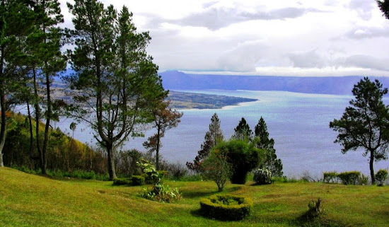
Toba Lake which has lovely views and is located in the province of North Sumatra is the largest lake in Southeast Asia. Toba Lake is classified as a volcanic lake as formed by ancient volcanic eruptions called Toba Mount. The explosion was so devastating to so-called supervulcano eruption which destroyed nearly half of life on Earth. Toba Lake is now the most important tourist destinations on the island of Sumatra.

Toba Lake, North Sumatra, Indonesia (Pic 1). AeroTourismZone
Toba Lake, North Sumatra, Indonesia (Pic 1).
Toba Lake is an amazing natural wonders on the island of Sumatera. It is hard to imagine a more beautiful place to visit in North Sumatra in addition to this lake. The atmosphere is cool and refreshing, a stretch of clear water and blue, green and charming views of the mountains is a small part of the image of a giant lake at an altitude of 900 meters above the sea level. Quoted from page IndonesiaTravel, Toba Lake is a crater lake covering an area of 1,145 square kilometers. In the middle there is an island with an area that is almost proportional to the area of Singapore.

Toba Lake is actually more like an ocean than a lake because the size is very large. Therefore, Toba Lake is placed as the largest lake in Southeast Asia and the second largest in the world after Lake Victoria in Africa. Toba Lake also includes the deepest lake in the world is approximately 450 meters.

Experts estimate that the lake formed after the eruption of the Toba supervolcano approximately 73000 - 75000 years ago. At that time 2,800 cubic km of volcanic material spewed out of Toba Mount erupted to volcanic ash in the wind spread to half the Earth. The explosion occurred during a week and throw the dust up to 10 kilometers above sea level. As a result of the eruption of a super volcano, Toba Mount is estimated to have caused mass death and extinction of several species of living creatures. The eruption of Toba Mount has led to changes in the earth's weather and the start into the ice age that affects the world civilization.

Toba Lake, North Sumatra, Indonesia (Pic 2). AeroTourismZone
Toba Lake, North Sumatra, Indonesia (Pic 2).
Surrounding communities, Toba Lake has a magical history that is believed to be the place to stay Namborru (seven goddess who became the ancestors of Batak Tribe). If the Batak tribe will perform a ceremony around the lake, then they should pray and ask permission Namborru.

Samosir Island is an island that is unique because it is a volcanic island in the middle of Toba Lake. The altitude of 1,000 meters above sea level. Although it has become a tourist destination for a long time, Samosir is the unspoiled natural beauty. In center the Samosir Island there are still two beautiful lake named Lake Sidihoni and Lake Aek Natonang. The area around Toba Lake has pine forests are arranged beautiful. On the outskirts of Toba Lake there are some seriously stunning waterfalls. Around Toba Lake you will also find belarang water baths.

At the Samosir Island you can also find misty mountains, crystal clear waterfalls to swim, and farming communities. Batak society friendliness will captivate you because wherever you go then immediately can find new friends.

In Parapat which is a peninsula that protrudes into the lake, you can enjoy a spectacular view of Toba Lake. Parapat inhabited the society Batak Simalungan and Batak Toba known to have cheerful and sociable nature. This community is famous also pleased sang the theme song of love that carefree yet soulful.

Toba Lake, North Sumatra, Indonesia (Pic 3). AeroTourismZone
Toba Lake, North Sumatra, Indonesia (Pic 3).
Now, Toba Lake became one of the best tourist destinations in Indonesia. The place where you can do a variety of activities to enjoy the natural beauty such as mountain climbing, swimming, or boating screen. The air was clean and cool with a quiet atmosphere and the people are friendly.

Many tourists prefer to stay on Samosir Island, located in the middle of the lake. As the original residence Batak Toba, Samosir Island has a legacy of antiquity of which is the grave stone and traditional villages. On this island you can find a unique culture and ancient Toba. Observe also the traditional architecture of the Toba Batak house compound. The natural beauty of the Samosir Island suggests that this is a suitable place to visit and avoid fatigue routines. Samosir easily accessible by ferries from Parapat. In Tomok also contained the tomb of King Sidabutar, which he was already 500 years. There is also the Sigale-Gale statue who can dance.

If you feel excited at Parapat, there are plenty of facilities for swimming, water skiing, riding a motor boat, canoe riding, fishing and playing golf. From Parapat, you can take a leisurely walk in the hills Naborsahon river and you'll see bougainvillea, pointetties, honey suckle spectacular and bloom throughout the year. Many visitors who come to spend time at the lake for a swim in the refreshing water or rent a sailboat to sail around Toba Lake. No need to worry stung by the sun because the climate here is cool and dry with beautiful lake views, this place is the ideal place to relax. See the sunset at Toba Lake is the perfect way to relax and enjoy time with your loved ones.

In Samosir, you can also stroll to the inland and explore two smaller lakes, the Lake Sididhoni and Aek Natonang. If you are still not satisfied with the atmosphere in Samosir, trekking to explore the interior of the plateau. Should ask the hotel or the local community about the route because the road is sometimes muddy and slippery depending on the weather.

If you are interested in history then visit the cemetery King Sidabutar, there you can see the unique megalithic cultural relics. If you want to know more about the life of the Batak, visit traditional villages that became a producer Jangga Ulos cloth. The village is about 24 km from Parapat. On the shores of Toba Lake is also visible Pensions Soekarno, the first Indonesian president exiled in the Dutch colonial era, with designs painted white building magnificent.

Thursday, December 17, 2015


Wakatobi National Marine Park, the beautiful underwater paradise

Wakatobi National Marine Park is considered one of the waters that have a wealth of marine life and coral reefs as the best in the world. In other words, Wakatobi marine tourism destination can be highly recommended for domestic and foreign tourists. Wakatobi is Southeast Sulawesi, Indonesia.

Wakatobi, Southeast Sulawesi, Indonesia. AeroTourismZone
Wakatobi, Southeast Sulawesi, Indonesia.
Did you know that Indonesia has one of the most beautiful underwater paradise on earth? Underwater paradise known as the Wakatobi National Marine Park is located in Wakatobi, Southeast Sulawesi, Indonesia. Wakatobi has capital in Wangi-Wangi. Wakatobi consists of four major islands, namely Wangiwangi, Kalidupa, Tomia, and Binongko. So, Wakatobi is an acronym for the name of the four main islands. Prior to December 18, 2003, these islands are called the Islands of Tukang Besi and is still a part of Buton.

Astronomically, Wakatobi located in the south of the equator, and like other regions in Indonesia, Wakatobi has two seasons, rainy and dry seasons. Wakatobi National Marine Park, inaugurated in 1996, with a total area of 1.39 million hectares, has a variety of marine biodiversity and coral which occupies one of the highest priority position of marine conservation in Indonesia.

The beauty and natural wealth in the Wakatobi National Park is already well known abroad, especially after Wallacea expedition from England in 1995 which mentions that the region of Southeast Sulawesi is very rich in coral species. There, there are 750 of the total 850 species of coral in the world. Configuring the depth varies from flat to sloping to the sea, and in some areas there is a rugged steep waters. The most deep waters reached a depth of 1044 meters.

Marine tourism is a tourist activity has long been recognized and is the mainstay of tourism in the Wakatobi National Marine Park. The wealth of marine life is because of the coral reefs along the vast waters of the underwater topography colorful as slop shape, flat, drop-off, atoll and underwater cave. More than 112 species of corals from 13 families including Acropora formosa, A. Hyacinthus, Psammocora profundasafla, Pavona cactus, Leptoseris yabei, Fungia molucensis, Lobophyllia robusta, Merulina ampliata, Platygyra versifora, Euphyllia glabrescens, Tubastraea frondes, Stylophora pistillata, Sarcophyton throchelliophorum who live in harmony with other underwater inhabitants.

Wakatobi Beach Pier. AeroTourismZone
Wakatobi Beach Pier.
The diversity of fish species that the park is owned as many as 93 species of fish including (Cephalopholus argus), takhasang (Naso unicornis), pogo-pogo (Balistoides viridescens), napoleon (Cheilinus undulatus), red fish (Lutjanus biguttatus), rabbitfish (Siganus guttatus) , Amphiprion melanopus, Chaetodon specullum, Chelmon rostratus, Heniochus acuminatus, Lutjanus monostigma, Caesio caerularea, and others.

Wakatobi National Marine Park is also a point of some kind of sea birds such as goose-brown stone (Sula leucogaster plotus), Malay plover (Charadrius peronii) and King Prawn Eurasia (Alcedo atthis) nested. Several species of turtles also make this park as their home, for example, hawksbill (Eretmochelys imbricata), loggerhead turtle (Caretta caretta), and fission turtle (Lepidochelys olivacea).

Wakatobi waters have loyal guests who make Wakatobi waters as a playground, the guest is the sperm whale (Physeter macrocephalus). Usually, the group of sperm whales in Wakatobi in November, while the other hemisphere freezes. In the month, the temperature in the Wakatobi relatively warmer waters and abundant food can be filling stomachs of whales herd. Not only that, Wakatobi is also a place to play manta rays (Manta ray) were classified as giant body size. Manta is one of the distinctive and unique fish, and is only found in tropical waters.

The presence of 25 pieces of coral reef with a depth that makes the waters ideal in Wakatobi National Marine Park as an ideal place for many species of marine life to live there, making the inhabitants of the sea here has aesthetic value and high conservation.

Specifically, the Wakatobi National Marine Park surrounded from the beach by coral islands along the 600 miles along the beach attractions with huge potential to run, spread throughout the Wakatobi region. It was not without reason that the beach area in Wakatobi is perfect for marine tourism activities such as diving, snorkeling, swimming and fishing.

Access to the Wakatobi islands can be reached by air. For air transport, usually preceded by the route of flight from Makassar to Kendari, the capital of Southeast Sulawesi province. Furthermore, the flight continued to Wangi-Wangi, Wakatobi capital. According to information, available at this time also had a direct flight from Makassar to Wangi-Wangi.

Wednesday, December 16, 2015


Senggigi Beach, tourism area in Lombok Island, West Nusa Tenggara

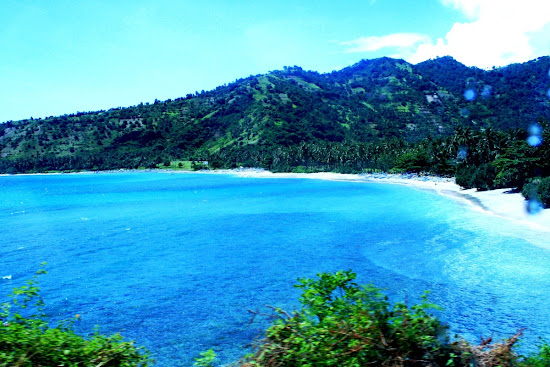
Senggigi Beach is a famous tourist area in Lombok Island, West Nusa Tenggara. Sightseeing Senggigi Beach is approximately 8 km from the city of Mataram. Senggigi Beach a destination that must be included in the travel destination on the island of Lombok.

Senggigi Beach, West Nusa Tenggara. AeroTourismZone
Senggigi Beach, West Nusa Tenggara.
Senggigi Beach is a famous tourist spot in Lombok. It is located on the west coast of the island of Lombok. Senggigi Beach is not as big as Kuta Beach in Bali, but when we are on this beach will feel like staying in Kuta Beach, Bali. Entering the area of Senggigi Beach, tourists seta immediately greeted by a soothing gentle breeze. Coastal beaches pristine and clean.

Underwater scenery in Senggigi Beach is very beautiful, and tourists can do as much snorkeling as the waves are not too big. Ketengah towering coral reefs cause large waves broke in the middle. There are also several hotels with rates that vary from expensive to economical hotel cost.

Senggigi Beach visited by many foreign tourists. Most of them spend time swimming and sunbathing. Which makes this beach so special long coastlines. Throughout the eye could see, tourists will be presented with the beauty of clean lines of Senggigi Beach. Consider carefully, there is uniqueness shown. Senggigi Beach sand is not all white, some black beach. Awesome!

Sea water in the Senggigi is so clear and clean. There is no waste at all in there. In fact, tourists can see the fish that are swimming freely with the herd from the top surface of the sea. Coral reefs on this coast is still maintained. Make sure when were in Senggigi Beach, you will not miss the underwater natural elegance. Take your snokeling tools, and dive into the underwater world Senggigi. Be witness to the beauty of the underwater world that has not been tainted Senggigi hands of ignorant humans.

Enjoy the fun atmosphere of Senggigi Beach in the afternoon before sunset. From a distance you can see the sun back into hiding. The sky looks bright white initially, slowly flushed. The sun looked down slowly and disappeared leaving darkness. Behind the white cloud, discover and capture the sun with your camera. Perfect!

Batu Bolong Temple, Lombok Island, West Nusa Tenggara. AeroTourismZone
Batu Bolong Temple, Lombok Island, West Nusa Tenggara.
Batu Bolong Temple

About half an hour by foot, the tourists can find the Batu Bolong Temple on this beach. This is a temple built on a rock which is located on the waterfront. According to the local legend of yore often held sacrifice of a virgin to fed to the sharks in this place. Another legend says the first widely fielded women away from this place into the sea because of a broken heart. Also visible from Mount Agung in Bali.

Batu Layar

Not far from Batu Bolong there is the tomb of a religious leader. This is a sacred place for the followers of Wetu Telu. Batu Layar crowded visit during "Lebaran Topat" which is Eid for the fasting person 1 week after Idul Fitri Eid.

If you are curious about the beauty of this beach, travelers can depart from Lombok International Airport heading West Lombok. Long the journey takes about 2 hours. Although the trip so far, it will all pay off with the beauty of the panorama.